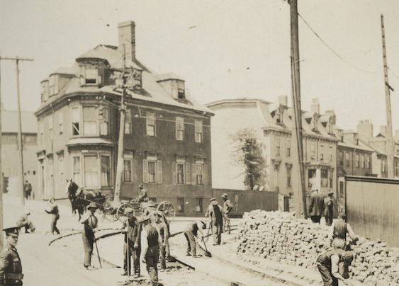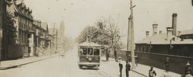
The installation of the tram tracks on Gottingen Street at Cogswell ca. 1891 – Nova Scotia Archives: Nova Scotia Light and Power Fonds, MG9, vol. 226, pg. 65.
Over the last year I have had the privilege to be involved with the organizing committee of the Gottingen 250 Festival from the earliest planning meetings right up to now and it has been extremely fulfilling to see the vision that the committee saw come together.
One of the legacy pieces that the Festival committee has been working on is a web-based Walking History Map App which will allow people to walk down the street and from the convenience of their tablets of cell phones learn about the history of the street and the people who have lived on it.
Today we can combine different media – photos, sound recordings, text – and present it on our crazy technology and walk down the street and learn about our neighbourhoods. However in the past we just had pen and paper. One of the richest historical resources we uncovered in our research for the Map App was a description of the street ca. 1875 written in 1940 by 73 year old Laleah M. Hendry.
So come, let’s take a walk down Gottingen Street in 1875…
The description of Gottingen Street ca. 1875 written by Hendry was done more than seventy years after she lived on the street and are recollections of when she was about eight years old. That being said this three page typescript (transcribed and presented here with its original notes and formatting) provides us with an amazing look back at a street that was primarily residential but had business and commercial enterprise, as well as a bear and a peacock.
Below is the recollection in its entirety. Immediately following the transcription I will try to identify some of the things she mentions as we walk from the North end of Gottingen Street to the intersection of Gottingen and Cogswell streets ca. 1875:
Old Gottingen Street About 1875
I sometimes wonder if there is anyone besides myself who remembers old Gottingen Street in the Seventies as I do. I was a small girl of eight years when we left that part of Halifax, but the street as it was then seems most clearly printed in my mind.
To begin at Fort Needham, to which was the longest walk we children ever took, somewhere near there further out I think were the two old Merkel homes, two very interesting old homes, then you came to Young Street running down to Lockman. Kaye Street running same way, on which was a Methodist Church, then St. Joseph’s Church, then Russell Street where was St. Mark’s Church.
To continue on Gottingen, you come now to Wellington Barracks, occupied by British Soldiery, where the high stone wall was only party built at that time, and the blanks filled in with a palisade of split poles through which we children peered in and sometimes, oh wonderful saw a bear tied to a pole. Then Dr. Walker’s beautiful home opposite, at which place I remember seeing peacocks. The fine old Admiralty house on East side, adjoining the barrack property, opposite again the old Bell home occupied by Hon. Hugh Bell, called Bloomfield, and entered by an avenue of trees from Gottingen. Then, on! Two beautiful homes opposite each other, at corners of North and Gottingen, lived in by Martin P. and Charles Black. At southwest corner was a dear old-fashioned house in from street lived in at one time by the Mackinlays, ancestors of Andrew and Williams Mackinlays who for years kept well known stationery shop on Granville Street. Then the old Harrington place, also in from street, and called “Hawthrone Place”, later turned into three dwelling houses, opposite the Hendry house, of which family I was a member.
Then Mrs. Clayton, mother of Clayton and Sons, and a Mr. McInnis next; next the Deaf and Dumb School, of which I remember a Mrs. Vinecove as matron and a Mr. Hutton as Superintendant. On other side of street lived a Mr. Sutcliffe and family, then came three houses alike, in one of which lived the Logan family for many years. Next came a house occupied by a Miss Clarke and her mother. Miss Clarke kept a small private school which I attended. Then came the Old Ladies Home, the original house I have heard was once owned and lived in by the Knight family, but was split in two, moved away and the present building took its place. Next to them came a Mr. Gully and family, and next again a Mr. James MacLearn and family, very dear friends of ours, then somewhere near, a house in from the street, which in that day of mine was occupied by Rev. Dr. Forrest, then pastor of St. John’s Church on Brunswick Street, and afterwards President of Dalhousie College. The Bayne family lived in a very nice stone house corner of Cunard Street, then North Baptist Church, since removed to Robie, and Zion Church, which I think is still there. A Mr. Parker lived in a very nice house in from street, and on other side a Colonel Clouleith, who kept several small dogs.
Am afraid my memory is failing as to other families on this street, but recall several shops, Liswell the baker, who made wonderful long molasses cakes and ginger breads all shiny on top, with blocks of pictures stamped on like the creamery butter is now, and wonderful hard biscuit, also a spongy kind of biscuit, and no baker these days made as good bread as they did.
Mrs. Campbell kept a candy shop corner of Cornwallis, all home-made and good beyond telling. A dear old coloured woman, who wore a bandana on her head, had a shop, and sold all sorts of herbs, lobsters and other things. I can remember the smell of that shop now, a sort of interesting witheroddy (blurred text) smell. Hemsworth, I think, kept a tobacco shop opposite Mrs. Campbell’s sweet shop. Various liquor and pork shops, one having a golden pig over the door (note: Carol Palm’s Pork Shop, Grandfather of Carl Bethune), in which we got all sorts of good things, hams, bacon, sausage, eggs, butter, etc., and those were the days when sausages were good. I can also recall the smell of those shops.
At the end of Gottingen near Cogswell street were some nice old homes with long steps leading up to them, and a family of MacNabs, friends of ours, lived in one of them. Rev. P. G. Macgregor had a very nice house further north, afterwards occupied by the very popular doctor, Dan Campbell, and facing up Gottingen on Cogswell Street was a large building called the Ball house, if I remember rightly, in which games were played by the Military.
Some more shops have come to my memory now, a tiny one kept by a Miss Ahern, in which one got needles, pins, sewing silks, twist, etc. Also a shop kept by the Misses Henneseys, and McPherson’s dry goods store, in which a pretty little lady served, who, as the years went on, never seemed to grow any older.
These are just the memories of an old woman trying to hark back seventy years, and may be interesting to some equally old person who will probably find me wrong in some of my memories. But one thing I do remember is that it was an interesting and pleasant old street, and I recall that the sun, in summer, set at the end of it and made a lovely afterglow of a beautiful summer evening.
Despite her age both in 1875 (about 8) and in 1940 (about 73) Laleah appears to have remembered quite a bit of history.
I don’t have the space to hit every single thing Laleah talked about but here are some highlights.
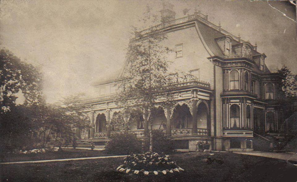
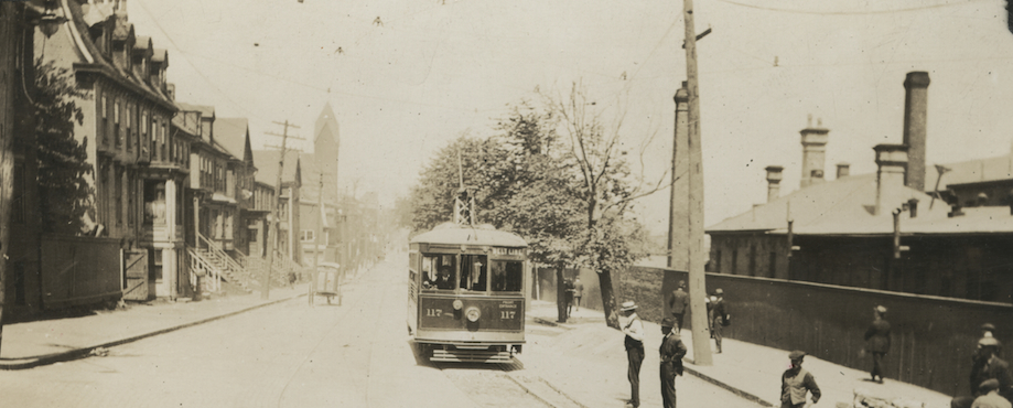
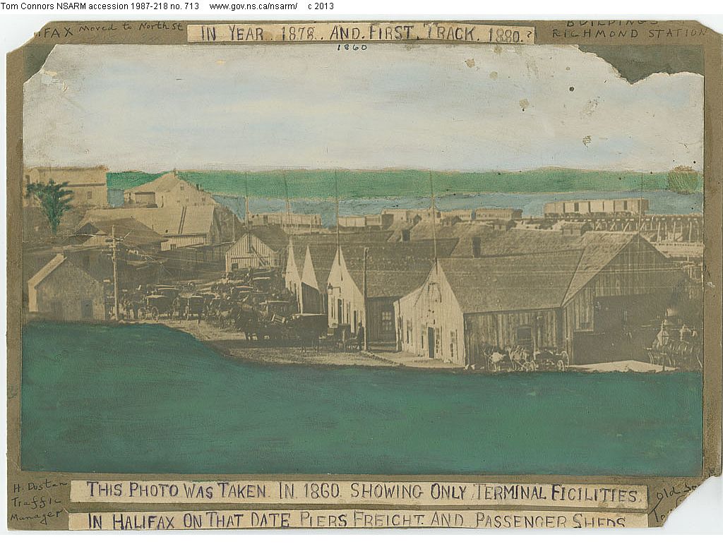
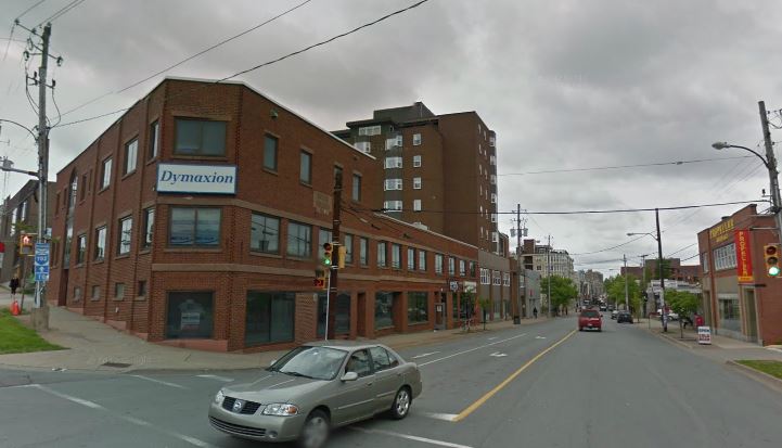
She talks about the stone house at the corner of Gottingen and Cunard Streets. Today this space is occupied by the former Scotia Bank building which is now the costume storage and repair facility for what I believe is the Royal Nova Scotia Tattoo. Below is a picture of that house:
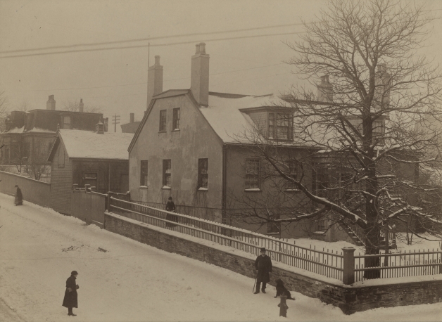
Corner of Cunard Street and Gottingen Street ca. 1891
You can see that the house was set back from the corner and had a considerable amount of property. Abutting the property in the background that still stands on the corner of Cunard and Creighton Streets.
Today adjacent to the house on the corner of the above mentioned streets is the former Cunard Street Theatre which today is used by the congregation of Revival Tabernacle. On the weekends in the summer, if you’re lucky, you’ll hear them singing gospel from the open windows.
Interestingly, in the 1925 this house was owned by Dr. Hawkins and was in bad shape; enough so that the City tried to have the owner fix it up or take care of it otherwise. The description of the building is as follows:
I beg to report on the condition of the buildings on the north-west corner of Cunard and Gottingen streets. There are three buildings on the property, the main building is a two and one half story building with a stone foundation and the northwall is stone and brick, the south and west walls are in the same condition as when the section of the building was cut off, no repairs having been made and they are very rough and untidy. The east wall is in fair condition. The other section is a two storey flat roof building and is placed on crib work in the rear of the main building. The third building is a one storey shed placed there by the Relief Commission after the Explosion and is used for storage. (Report to Halifax City Council re: Hawkins Property as reported in Halifax Evening Mail, 7 October 1925).
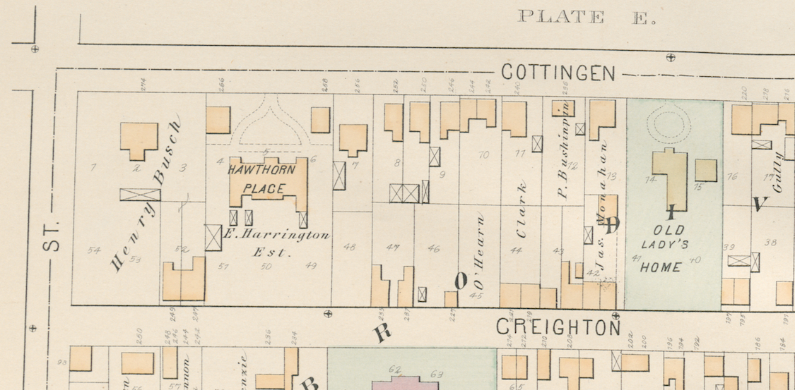
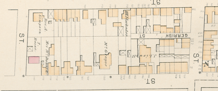
You can see, as well, from this portion of the 1878 Hopkins Atlas, the block of Gottingen between Gerrish (today’s Buddy Daye Street) and Cunard Streets:
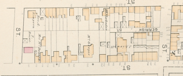
1878 Hopkins Atlas of Halifax, portion of Plate F, showing the West side of Gottingen Street between Gerrish and Cunard Streets.
Starting at the corner of Cunard and Gottingen, on the West side, and walking North you have the stone Bayne family house mentioned by Laleah. Then, in the middle of the block you have the large McGregor house that is situated in from the street and then adjacent to that the Liswell Bakery where Laleah enjoyed many sweets and pastries.
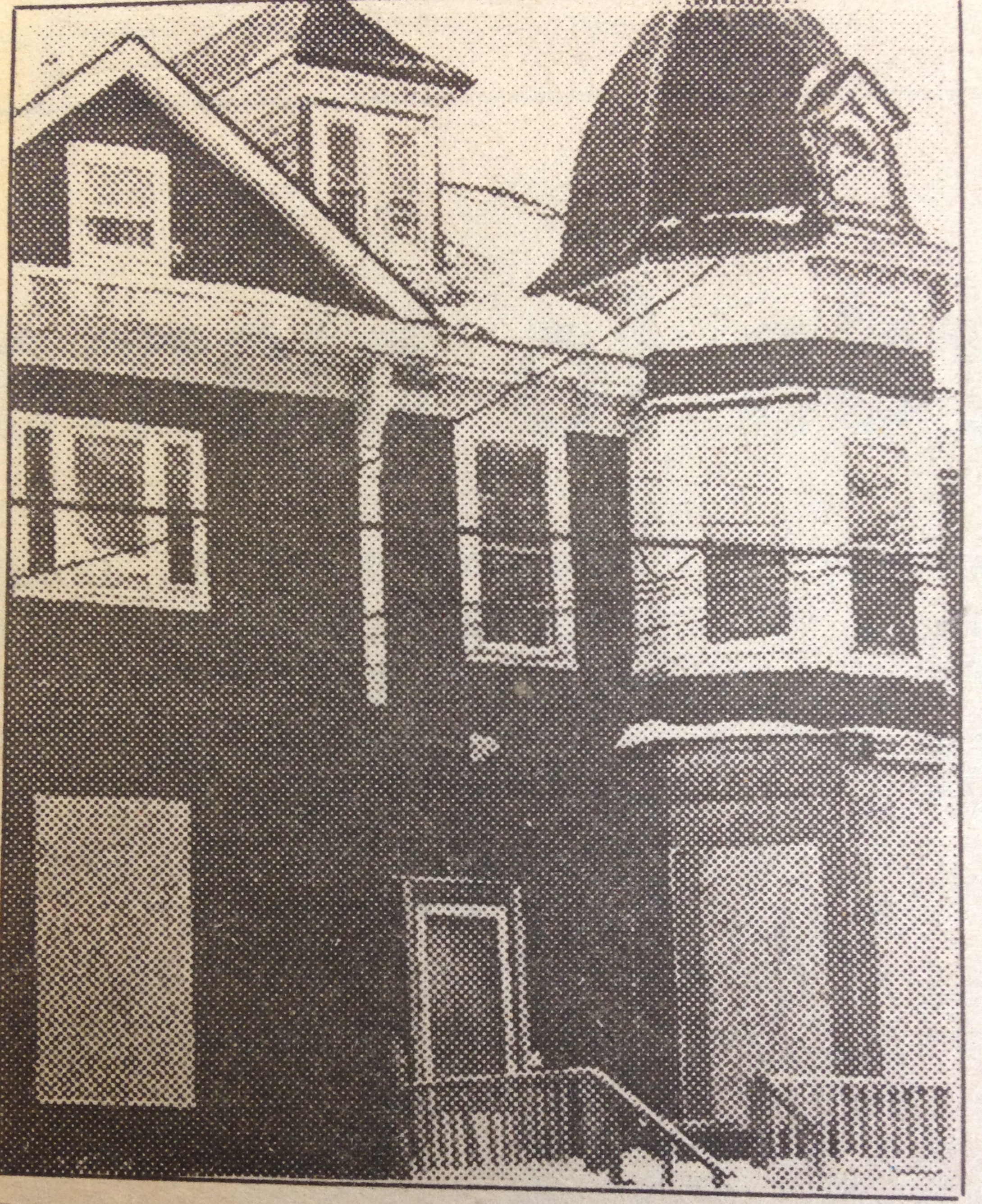
The McGregor House is also know as the Mignowitz House and we are lucky as a picture of this building has also survived:
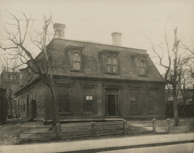
The McGregor/Mingowitz House, Gottingen Street.
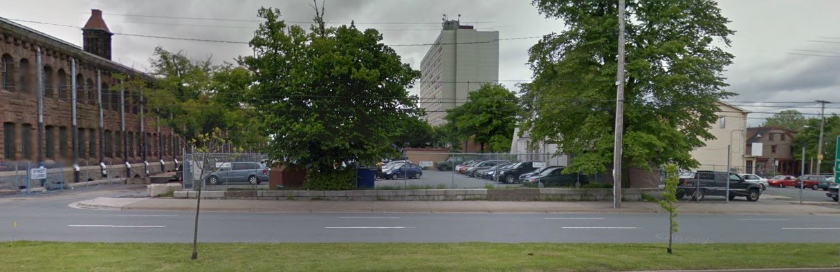
This building was located in the centre of the block roughly where the former Sobey’s used to be in the empty lot across from the Library.
Laleah’s recollection is so packed full of historical insight that I’ve decided to break this post up over two posts. The second post will examine some of the businesses and the Hendry family itself.
______________
Sources: All images used above have been purchased from and are the copyright of the Nova Scotia Archives for use in the Map App project of the Gottingen 250 Festival and are being used here on The Old North End blog to help promote the Map App Project. Primary source research has been conducted entirely by myself, Nathaniel Smith, for use in the Map App project as well as for this blog.